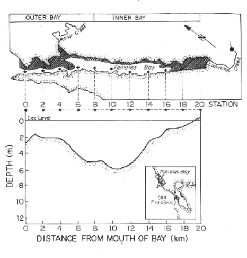
 Figure 1. Map of Tomales Bay sampling stations. Water temperature monitoring was conducted at stations 0 (bottom), 8 (surface/bottom), 12 (surface/bottom), 16 (bottom), and Lagunitas Creek (bottom).
Water temperature has been measured with Ryan tempmentors, at 4 locations in Tomales Bay (Stations 0 and 16-bottom-mounted sensors; stations 8 and 12 surface and bottom mounted sensors on spar buoys; see Figure 1 for station locations) continuously (except for problems including equipment loss or malfunction, etc.) since 1987. Between 1990 and 1995 (again, with some interruptions) a similar record was maintained at the Lagunitas Creek stream gauge location.
Data are collected at 30-minute intervals and then binned into 1-day averages. With these settings, the thermographs could store data for approximately 4 months. Typically the instruments were retrieved and redeployed at 2-month intervals. Precision and accuracy of the tempmentors is better than +/- 0.2 deg. C.
