 Figure
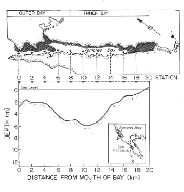
1. Map of Tomales Bay sampling stations. Dome fluxes were measured at stations
near station 6, 10, and 16, at water depths between 2.5 and 4.0 m.
Figure
1. Map of Tomales Bay sampling stations. Dome fluxes were measured at stations
near station 6, 10, and 16, at water depths between 2.5 and 4.0 m. Domes were emplaced and sampled according to the procedures described in Dollar et al. (1991) (see reference in LMER/BRIE publications list). Incubations were typically 20-26 hours. For the analytical measurement methods, see references in Smith et al. (1991). TA and DIC data are corrected for nutrient fluxes. Rates reported in micromoles per square meter per day (microequivalents, in the case of alkalinity).
